
Singleton Park topographic map
Interactive map
Click on the map to display elevation.
About this map
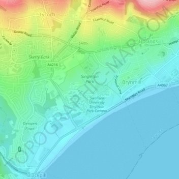
Name: Singleton Park topographic map, elevation, terrain.
Location: Singleton Park, Sketty, Swansea, Wales, United Kingdom (51.60587 -3.98986 51.61691 -3.97317)
Average elevation: 40 m
Minimum elevation: -1 m
Maximum elevation: 165 m
Swansea trails, hiking, mountain biking, running and outdoor activities
Other topographic maps
Click on a map to view its topography, its elevation and its terrain.