
Nanded topographic map
Interactive map
Click on the map to display elevation.
About this map
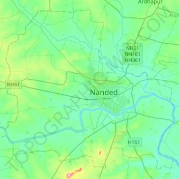
Name: Nanded topographic map, elevation, terrain.
Location: Nanded, Nanded district, Maharashtra, India (19.06889 77.16199 19.27655 77.40834)
Average elevation: 371 m
Minimum elevation: 339 m
Maximum elevation: 506 m
Other topographic maps
Click on a map to view its topography, its elevation and its terrain.