
Thank you for supporting this site ❤️
Make a donation
Make a donation
Gear up for your next adventure:
As an Amazon Associate, this site earns from qualifying purchases at no extra cost to you.
Anjarle topographic map
Click on the map to display elevation.
Thank you for supporting this site ❤️
Make a donation
Make a donation
Gear up for your next adventure:
As an Amazon Associate, this site earns from qualifying purchases at no extra cost to you.
About this map
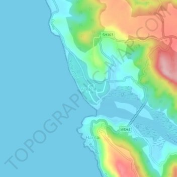
Name: Anjarle topographic map, elevation, terrain.
Location: Anjarle, Dapoli Taluka, Ratnagiri, 415714, India (17.82758 73.07028 17.86758 73.11028)
Average elevation: 37 m
Minimum elevation: 0 m
Maximum elevation: 188 m
Thank you for supporting this site ❤️
Make a donation
Make a donation
Gear up for your next adventure:
As an Amazon Associate, this site earns from qualifying purchases at no extra cost to you.