
Sankoo topographic map
Interactive map
Click on the map to display elevation.
About this map
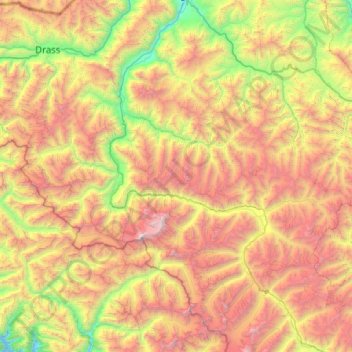
Name: Sankoo topographic map, elevation, terrain.
Location: Sankoo, Kargil District, Ladakh, India (33.75735 75.67287 34.49644 76.68629)
Average elevation: 4,410 m
Minimum elevation: 2,694 m
Maximum elevation: 7,057 m
Other topographic maps
Click on a map to view its topography, its elevation and its terrain.