
Nanu Oya topographic map
Interactive map
Click on the map to display elevation.
About this map
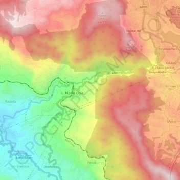
Name: Nanu Oya topographic map, elevation, terrain.
Location: Nanu Oya, Nuwara Eliya District, Central Province, 52, Sri Lanka (6.93118 80.72057 6.95248 80.78023)
Average elevation: 1,789 m
Minimum elevation: 1,331 m
Maximum elevation: 2,149 m