
Summit Township topographic map
Interactive map
Click on the map to display elevation.
About this map
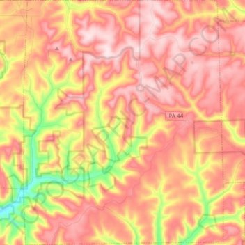
Name: Summit Township topographic map, elevation, terrain.
Location: Summit Township, Potter County, Pennsylvania, United States (41.62286 -77.96575 41.73660 -77.84138)
Average elevation: 651 m
Minimum elevation: 421 m
Maximum elevation: 792 m
Other topographic maps
Click on a map to view its topography, its elevation and its terrain.
Patterson State Park
United States > Pennsylvania > Potter County > Summit Township
Patterson State Park, Summit Township, Potter County, Pennsylvania, United States
Average elevation: 708 m