
Poprad topographic map
Interactive map
Click on the map to display elevation.
About this map
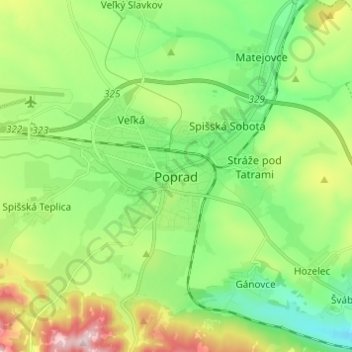
Name: Poprad topographic map, elevation, terrain.
Average elevation: 699 m
Minimum elevation: 584 m
Maximum elevation: 932 m
International Poprad–Tatry Airport from 1938, is an airport with the highest elevations in Central Europe. It also offers scheduled flights to London.