
Thornhill topographic map
Interactive map
Click on the map to display elevation.
About this map
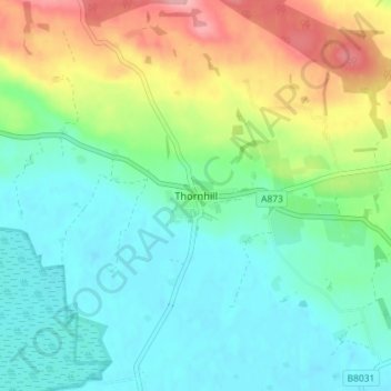
Name: Thornhill topographic map, elevation, terrain.
Location: Thornhill, Stirling, Scotland, FK8 3PR, United Kingdom (56.15373 -4.17314 56.19373 -4.13314)
Average elevation: 46 m
Minimum elevation: 8 m
Maximum elevation: 132 m