
Dera Ismail Khan topographic map
Interactive map
Click on the map to display elevation.
About this map
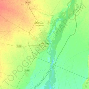
Name: Dera Ismail Khan topographic map, elevation, terrain.
Average elevation: 177 m
Minimum elevation: 162 m
Maximum elevation: 199 m
Other topographic maps
Click on a map to view its topography, its elevation and its terrain.
Daraban Tehsil
Pakistan > Khyber Pakhtunkhwa > Dera Ismail Khan District
Daraban Tehsil, Dera Ismail Khan District, Dera Ismail Khan Division, Khyber Pakhtunkhwa, Pakistan
Average elevation: 272 m