
Manarola topographic map
Interactive map
Click on the map to display elevation.
About this map
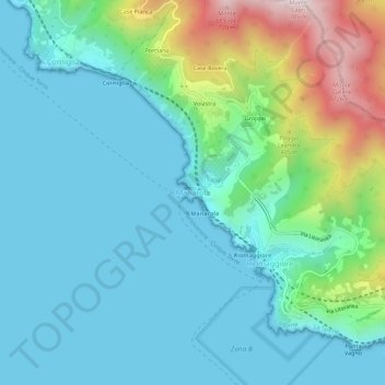
Name: Manarola topographic map, elevation, terrain.
Location: Manarola, Riomaggiore, Follo, La Spezia, Liguria, 19017, Italy (44.08633 9.70748 44.12633 9.74748)
Average elevation: 161 m
Minimum elevation: 0 m
Maximum elevation: 759 m
Other topographic maps
Click on a map to view its topography, its elevation and its terrain.