
Escazú topographic map
Interactive map
Click on the map to display elevation.
About this map
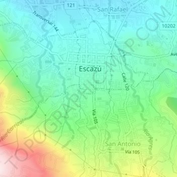
Name: Escazú topographic map, elevation, terrain.
Location: Escazú, Cantón Escazú, San Jose Province, 10201, Costa Rica (9.90407 -84.16161 9.92790 -84.13011)
Average elevation: 1,171 m
Minimum elevation: 1,027 m
Maximum elevation: 1,517 m
Escazú has an area of 34.49 km² and a mean elevation of 1,129 metres.