
Tatsfield topographic map
Interactive map
Click on the map to display elevation.
About this map
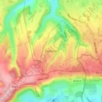
Name: Tatsfield topographic map, elevation, terrain.
Location: Tatsfield, Surrey, South East, England, TN16 2BD, United Kingdom (51.27545 0.00602 51.31545 0.04602)
Average elevation: 201 m
Minimum elevation: 127 m
Maximum elevation: 270 m
Other topographic maps
Click on a map to view its topography, its elevation and its terrain.
Titsey Plantation
United Kingdom > England > Tatsfield > Titsey
Titsey Plantation, Titsey, Tatsfield, Tandridge, Surrey, South East, England, United Kingdom
Average elevation: 194 m