
Monteverde topographic map
Interactive map
Click on the map to display elevation.
About this map
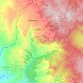
Name: Monteverde topographic map, elevation, terrain.
Average elevation: 1,209 m
Minimum elevation: 397 m
Maximum elevation: 1,836 m
Other topographic maps
Click on a map to view its topography, its elevation and its terrain.
Santa Elena
Costa Rica > Cantón Monteverde > Monteverde
Santa Elena, Monteverde, Cantón Monteverde, Puntarenas Province, 61201, Costa Rica
Average elevation: 1,295 m