
Hartley Wintney topographic map
Interactive map
Click on the map to display elevation.
About this map
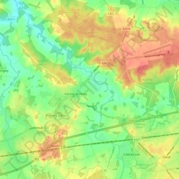
Name: Hartley Wintney topographic map, elevation, terrain.
Location: Hartley Wintney, Hart, Hampshire, England, United Kingdom (51.28698 -0.94747 51.32863 -0.83358)
Average elevation: 74 m
Minimum elevation: 45 m
Maximum elevation: 107 m
Other topographic maps
Click on a map to view its topography, its elevation and its terrain.
Hartfordbridge
United Kingdom > England > Hampshire > Hart > Hartley Wintney
Hartfordbridge, Hartley Wintney, Hart, Hampshire, England, RG27 8AF, United Kingdom
Average elevation: 76 m