
Pinxton topographic map
Interactive map
Click on the map to display elevation.
About this map
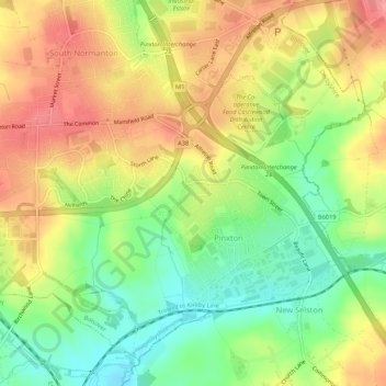
Name: Pinxton topographic map, elevation, terrain.
Location: Pinxton, Bolsover, Derbyshire, England, United Kingdom (53.08097 -1.35369 53.10868 -1.30062)
Average elevation: 122 m
Minimum elevation: 79 m
Maximum elevation: 163 m
Derbyshire trails, hiking, mountain biking, running and outdoor activities
Other topographic maps
Click on a map to view its topography, its elevation and its terrain.
Creswell Model Village
United Kingdom > England > Derbyshire > Bolsover > Creswell Model Village
Average elevation: 101 m