
Cambourne topographic map
Interactive map
Click on the map to display elevation.
About this map
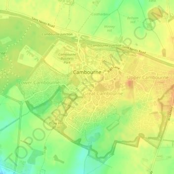
Name: Cambourne topographic map, elevation, terrain.
Average elevation: 65 m
Minimum elevation: 45 m
Maximum elevation: 76 m
Other topographic maps
Click on a map to view its topography, its elevation and its terrain.
Lake Ewart
United Kingdom > England > Cambourne
Lake Ewart, Crow Dene Bridleway, Cambourne, Cambridgeshire, East of England, England, CB23 5EP, United Kingdom
Average elevation: 63 m