
Cumming topographic map
Interactive map
Click on the map to display elevation.
About this map
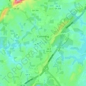
Name: Cumming topographic map, elevation, terrain.
Location: Cumming, Forsyth County, Georgia, United States (34.17157 -84.15790 34.23348 -84.09581)
Average elevation: 365 m
Minimum elevation: 313 m
Maximum elevation: 544 m
Other topographic maps
Click on a map to view its topography, its elevation and its terrain.
Lake Lanier
United States > Georgia > Forsyth County > Cumming
Lake Lanier, Cumming, Forsyth County, Georgia, 30506, United States
Average elevation: 351 m