
County Donegal topographic map
Interactive map
Click on the map to display elevation.
About this map
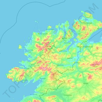
Name: County Donegal topographic map, elevation, terrain.
Location: County Donegal, Ulster, Ireland (54.45905 -8.83471 55.43530 -6.92273)
Average elevation: 74 m
Minimum elevation: -4 m
Maximum elevation: 697 m
The majority of Donegal has a temperate oceanic climate (Köppen climate classification: Cfb), with upland areas in the Derryveagh and Blue Stack ranges classified as oceanic subpolar (Köppen climate classification: Cfc). The county's climate is heavily influenced by the North Atlantic Current. Due to the topography of western Donegal, it receives orographic rainfall, where the air is forced to rise on contact with its mountainous coastline and subsequently cools and condenses, forming clouds. The mountains of Donegal are among the cloudiest places in Ireland, and northern Donegal is the windiest. Irish monthly record wind speeds for March, June, July, September, November and December have all been set at Malin Head. The highest wind speed ever recorded in Donegal was 181 km/h (112 mph) on 16 September 1961, during Hurricane Debbie.
Other topographic maps
Click on a map to view its topography, its elevation and its terrain.
Dublin (Finglas)
Ireland > County Dublin > Dublin
Dublin (Finglas), Dublin, Fingal, County Dublin, Leinster, Ireland
Average elevation: 48 m
Rathmore
Rathmore, Rathmore ED, Killarney Municipal District, County Kerry, Munster, P51 PT66, Ireland
Average elevation: 149 m
Nenagh
Nenagh, The Municipal District of Nenagh, County Tipperary, Munster, Ireland
Average elevation: 59 m
The Municipal District of Adare — Rathkeale
The Municipal District of Adare — Rathkeale, County Limerick, Munster, Ireland
Average elevation: 74 m
Meenane
Meenane, Watergrasshill, Municipal District of Cobh, County Cork, Munster, Ireland
Average elevation: 173 m
Carrowmore
Carrowmore, Kilmacowen ED, Sligo Municipal Borough District, County Sligo, Connacht, Ireland
Average elevation: 36 m
Ballinasloe
Ballinasloe, County Galway, Connacht, Ireland
Average elevation: 46 m
Curraghboy
Curraghboy, Castleffrench ED, Ballinasloe Municipal District, County Galway, Connacht, Ireland
Average elevation: 53 m
Corballis
Corballis, Donabate DED 1986, Fingal, County Dublin, Leinster, Ireland
Average elevation: 3 m
Murreagh
Murreagh, Kenmare Municipal District, County Kerry, Munster, V92 P681, Ireland
Average elevation: 37 m
Grand Canal - Barrow Line
Ireland > County Kildare > Athy
Grand Canal - Barrow Line, Athy, Athy Urban West ED, The Municipal District of Athy, County Kildare, Leinster, R14 EH50, Ireland
Average elevation: 60 m
Clooney
Clooney, Killaloe Municipal District, County Clare, Munster, Ireland
Average elevation: 57 m
Dunfanaghy
Dunfanaghy, County Donegal, F92 H0CY, Ireland
Average elevation: 23 m
Doonbeg
Doonbeg, West Clare Municipal District, County Clare, Munster, Ireland
Average elevation: 11 m
Ballyconneely
Ballyconneely, Conamara Municipal District, County Galway, Connacht, Ireland
Average elevation: 8 m
Ballyliffin
Ballyliffin, Inishowen Municipal District, County Donegal, Ulster, Ireland
Average elevation: 76 m
Ballyjamesduff Municipal District
Ballyjamesduff Municipal District, County Cavan, Ulster, Ireland
Average elevation: 100 m
Burrow
Burrow, Kilcumeragh ED, The Municipal District of Tullamore, County Offaly, Leinster, Ireland
Average elevation: 64 m
Lisfannan
Lisfannan, Burt ED, Inishowen Municipal District, County Donegal, Ireland
Average elevation: 48 m
Lahinch
Lahinch, Ennistimon ED, West Clare Municipal District, County Clare, Munster, Ireland
Average elevation: 35 m
Dough
Dough, Crookhaven ED, West Cork, County Cork, Munster, Ireland
Average elevation: 35 m
Bartragh
Bartragh, Castleconor West Electoral Division, Ballymote-Tubbercurry Municipal District, County Sligo, Connacht, Ireland
Average elevation: 6 m
Dooaghs
Dooaghs, Caragh ED, Kenmare Municipal District, County Kerry, Munster, Ireland
Average elevation: 10 m
Murvagh Lower
Murvagh Lower, Ballintra ED, Donegal Municipal District, County Donegal, Ireland
Average elevation: 2 m
Cruit Island
Cruit Island, Rutland ED, Glenties Municipal District, County Donegal, Ireland
Average elevation: 6 m
Rosses Upper
Rosses Upper, Drumcliff West ED, Sligo Municipal Borough District, County Sligo, Connacht, Ireland
Average elevation: 8 m
Rosses Point
Rosses Point, County Sligo, Connacht, Ireland
Average elevation: 8 m
Donabate
Donabate, Semple Woods, Donabate DED 1986, Fingal, County Dublin, Leinster, Ireland
Average elevation: 6 m
Stradbally
Stradbally, Stradbally ED, The Municipal District of Graiguecullen — Portarlington, County Laois, Leinster, Ireland
Average elevation: 92 m
Castlegregory
Castlegregory, Kenmare Municipal District, County Kerry, Munster, V92 F6NX, Ireland
Average elevation: 17 m
Bandon
Bandon, The Municipal District of Bandon-Kinsale, County Cork, Munster, Ireland
Average elevation: 59 m
Kilgarvan
Kilgarvan, Kilgarvan ED, Kenmare Municipal District, County Kerry, Munster, Ireland
Average elevation: 71 m
Carrowbunnaun
Carrowbunnaun, Knockaree ED, Sligo Municipal Borough District, County Sligo, Connacht, Ireland
Average elevation: 36 m
Termonfeckin
Termonfeckin, Termonfeckin ED, The Borough District of Drogheda, County Louth, Leinster, Ireland
Average elevation: 16 m
Bearlough
Bearlough, Toomour ED, Ballymote-Tubbercurry Municipal District, County Sligo, Connacht, Ireland
Average elevation: 72 m
Croaghross
Ireland > County Donegal > Letterkenny
Croaghross, Greenfort ED, Letterkenny, County Donegal, Ireland
Average elevation: 25 m
Illanoona
Illanoona, Corraun Achill ED, Westport-Belmullet Municipal District, County Mayo, Connacht, Ireland
Average elevation: 20 m
Baltray
Baltray, Termonfeckin ED, The Borough District of Drogheda, County Louth, Leinster, Ireland
Average elevation: 3 m