
Manorhamilton topographic map
Interactive map
Click on the map to display elevation.
About this map
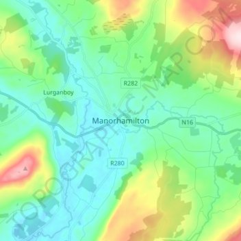
Name: Manorhamilton topographic map, elevation, terrain.
Location: Manorhamilton, County Leitrim, Connacht, Ireland (54.26404 -8.21544 54.34404 -8.13544)
Average elevation: 137 m
Minimum elevation: 32 m
Maximum elevation: 445 m