
Newry topographic map
Interactive map
Click on the map to display elevation.
About this map
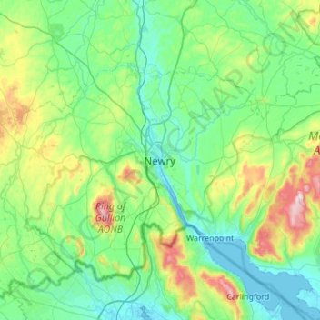
Name: Newry topographic map, elevation, terrain.
Location: Newry, County Down, Northern Ireland, BT35 6BH, United Kingdom (54.01753 -6.49751 54.33753 -6.17751)
Average elevation: 129 m
Minimum elevation: -1 m
Maximum elevation: 632 m
Northern Ireland trails, hiking, mountain biking, running and outdoor activities
Other topographic maps
Click on a map to view its topography, its elevation and its terrain.