
Kirton in Lindsey topographic map
Interactive map
Click on the map to display elevation.
About this map
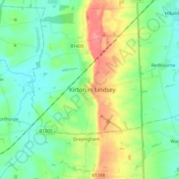
Name: Kirton in Lindsey topographic map, elevation, terrain.
Average elevation: 29 m
Minimum elevation: 6 m
Maximum elevation: 78 m
Other topographic maps
Click on a map to view its topography, its elevation and its terrain.
Cleatham
United Kingdom > England > Kirton in Lindsey > Cleatham
Cleatham, Kirton in Lindsey, North Lincolnshire, Yorkshire and the Humber, England, DN21 4JN, United Kingdom
Average elevation: 36 m