
Gunung Bunga Buah topographic map
Interactive map
Click on the map to display elevation.
About this map
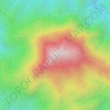
Name: Gunung Bunga Buah topographic map, elevation, terrain.
Location: Gunung Bunga Buah, Selayang, Malaysia (3.37409 101.73963 3.37419 101.73973)
Average elevation: 1,021 m
Minimum elevation: 695 m
Maximum elevation: 1,396 m
Other topographic maps
Click on a map to view its topography, its elevation and its terrain.
Kampung Sri Gombak Indah
Malaysia > Selangor > Selayang > Kampung Sri Gombak Indah
Kampung Sri Gombak Indah, Selayang, 68100, Malaysia
Average elevation: 84 m