
Kelvedon Hatch topographic map
Interactive map
Click on the map to display elevation.
About this map
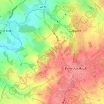
Name: Kelvedon Hatch topographic map, elevation, terrain.
Average elevation: 73 m
Minimum elevation: 32 m
Maximum elevation: 107 m
Other topographic maps
Click on a map to view its topography, its elevation and its terrain.
Blackmore, Hook End and Wyatts Green
United Kingdom > England > Brentwood
Blackmore, Hook End and Wyatts Green, Brentwood, Essex, England, United Kingdom
Average elevation: 81 m
Hutton
United Kingdom > England > Brentwood > Hutton
Hutton, Brentwood, Essex, East of England, England, CM13 1QR, United Kingdom
Average elevation: 66 m
Brook Street
United Kingdom > England > Brentwood > Brook Street
Brook Street, Brentwood, Essex, East of England, England, CM14 4PG, United Kingdom
Average elevation: 75 m
Herongate and Ingrave
United Kingdom > England > Brentwood
Herongate and Ingrave, Brentwood, Essex, East of England, England, United Kingdom
Average elevation: 64 m