
Covington topographic map
Interactive map
Click on the map to display elevation.
About this map
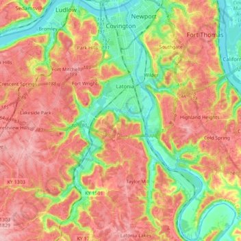
Name: Covington topographic map, elevation, terrain.
Location: Covington, Kenton County, Kentucky, United States (38.96456 -84.55480 39.09768 -84.47971)
Average elevation: 216 m
Minimum elevation: 139 m
Maximum elevation: 285 m
Other topographic maps
Click on a map to view its topography, its elevation and its terrain.
Sunny Acres
United States > Kentucky > Kenton County > Taylor Mill > Sunny Acres
Average elevation: 216 m