
Mount Cook topographic map
Interactive map
Click on the map to display elevation.
Mount Cook
Temperatures at the mountain's base in the Hooker Valley around 800 metres (2,600 feet) range from −13 °C (9 °F) to 32 °C (90 °F), and generally fall just over 1 °C for every 200 metres of altitude.
About this map
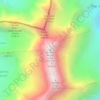
Name: Mount Cook topographic map, elevation, terrain.
Location: Mount Cook, Mackenzie District, New Zealand (-43.59505 170.14212 -43.59495 170.14222)
Average elevation: 2,920 m
Minimum elevation: 2,235 m
Maximum elevation: 3,709 m