
Rayong topographic map
Interactive map
Click on the map to display elevation.
About this map
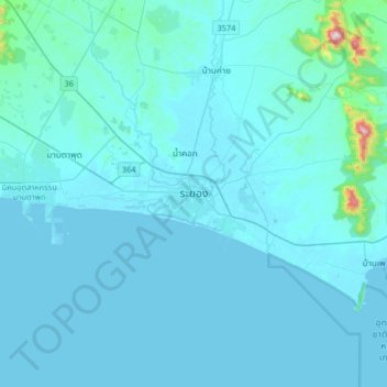
Name: Rayong topographic map, elevation, terrain.
Location: Rayong, Choeng Noen, Rayong Province, 21000, Thailand (12.52179 101.11777 12.84179 101.43777)
Average elevation: 31 m
Minimum elevation: -3 m
Maximum elevation: 687 m
Other topographic maps
Click on a map to view its topography, its elevation and its terrain.
Map Kha Phatthana
Map Kha Phatthana, Rayong Province, Thailand
Average elevation: 50 m
Ban Chang
Ban Chang, Rayong Province, 21130, Thailand
Average elevation: 32 m
Chom Phon Chao Phraya
Thailand > Rayong Province > Chom Phon Chao Phraya
Chom Phon Chao Phraya, Rayong Province, Thailand
Average elevation: 89 m
Pluak Daeng
Thailand > Rayong Province > Pluak Daeng
Pluak Daeng, Rayong Province, Thailand
Average elevation: 67 m
Ban Phe
Thailand > Rayong Province > Ban Phe
Ban Phe, Rayong Province, 21160, Thailand
Average elevation: 15 m
Lan Hin Khao Beach
Thailand > Rayong Province > Lan Hin Khao Beach
Lan Hin Khao Beach, Rayong Province, Thailand
Average elevation: 5 m
Ban Chang
Thailand > Rayong Province > Ban Chang
Ban Chang, Rayong Province, TUNG PONG, Thailand
Average elevation: 58 m
Ban Pak Don
Thailand > Rayong Province > Ban Pak Don
Ban Pak Don, Rayong Province, 21190, Thailand
Average elevation: 11 m