
Ongole topographic map
Interactive map
Click on the map to display elevation.
About this map
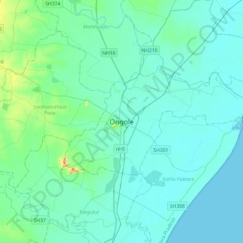
Name: Ongole topographic map, elevation, terrain.
Location: Ongole, Prakasam, Andhra Pradesh, 523002, India (15.34587 79.88995 15.66587 80.20995)
Average elevation: 15 m
Minimum elevation: 0 m
Maximum elevation: 137 m