
Lake Champlain topographic map
Interactive map
Click on the map to display elevation.
About this map
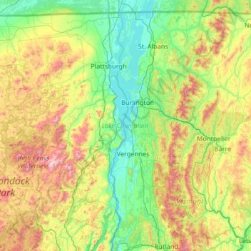
Name: Lake Champlain topographic map, elevation, terrain.
Location: Lake Champlain, Grand Isle County, Vermont, United States (43.58320 -73.46064 45.08506 -73.07591)
Average elevation: 355 m
Minimum elevation: 25 m
Maximum elevation: 1,543 m
Other topographic maps
Click on a map to view its topography, its elevation and its terrain.
Grand Isle
United States > Vermont > Grand Isle County
Grand Isle, Grand Isle County, Vermont, 05458, United States
Average elevation: 36 m