
Jackson topographic map
Interactive map
Click on the map to display elevation.
Jackson
Jackson is located at 43°28′31″N 110°46′9″W / 43.47528°N 110.76917°W / 43.47528; -110.76917 (43.475, −110.769), at an elevation of 6,237 feet (1,901 m) above sea level. According to the United States Census Bureau, the town has a total area of 2.95 square miles (7.64 km2), of which 2.91 square miles (7.54 km2) is land and 0.04 square miles (0.10 km2) is water.
About this map
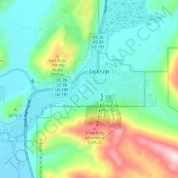
Name: Jackson topographic map, elevation, terrain.
Location: Jackson, Teton County, Wyoming, United States (43.45819 -110.81343 43.49046 -110.73764)
Average elevation: 2,043 m
Minimum elevation: 1,857 m
Maximum elevation: 2,511 m
Other topographic maps
Click on a map to view its topography, its elevation and its terrain.
Rocky Mountains
United States > Wyoming > Teton County
Agriculture and forestry are major industries. Agriculture includes dryland and irrigated farming and livestock grazing. Livestock are frequently moved between high-elevation summer pastures and low-elevation winter pastures, a practice known as transhumance.
Average elevation: 2,292 m
Jenny Lake
United States > Wyoming > Teton County
Jenny Lake is a starting point for many day and overnight hiking trips. The 7.1-mile (11.4 km) Jenny Lake Trail loops around the lake and is considered to be relatively easy due to the small altitude gain of 700 feet (210 m). However, the altitude increases rapidly once Cascade Canyon is entered.
Average elevation: 2,109 m
Upper Geyser Basin
United States > Wyoming > Teton County > Upper Geyser Basin
Average elevation: 2,295 m