
Colca Canyon topographic map
Interactive map
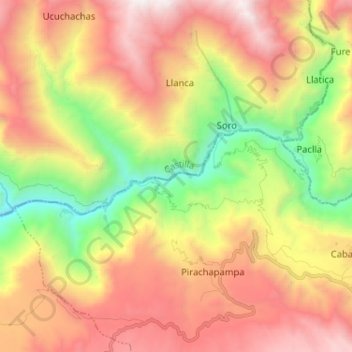
Click on the map to display elevation.
About this map
Name: Colca Canyon topographic map, elevation, terrain.
Average elevation: 3,169 m
Minimum elevation: 1,788 m
Maximum elevation: 4,565 m
Colca-Arequipa 14 plains of Majes, it is known as the Majes River, and then is known as the Camana before reaching the Pacific Ocean at the town of that name. The Majes River was believed by the Incas to flow directly into the Milky Way. For this reason, they often put sacrifices and gifts to the gods in the river for it to flow to them. Within the province of Caylloma it is known as the "Colca Valley" between Callalli and Pinchollo/Madrigal. Down to Huambo it is known as the Colca Canyon. The town of Chivay is located at the midpoint of the Colca valley. Above Chivay, at an elevation of 3,500 metres (11,500 ft), agriculture gives way to livestock raising, principally alpacas and llamas, with some sheep and dairy cattle as well. Below Chivay the valley presents intensely terraced landscapes, continuing for many kilometers downstream. Within the deepening valley downriver, a series of small villages is spread out over the approximately 56 kilometres (35 mi) between Chivay and the village of Cabanaconde. The canyon reaches its greatest depth in the region of Huambo, where the river has an elevation of 1,066 metres (3,497 ft). In contrast, 24 kilometres (15 mi) to the southeast of Cabanaconde rises the 6,288 metres (20,630 ft) high Ampato, a snow-capped extinct volcano.