
Maharagama topographic map
Interactive map
Click on the map to display elevation.
About this map
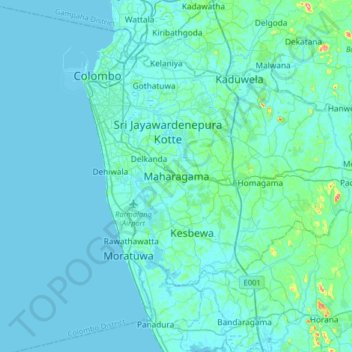
Name: Maharagama topographic map, elevation, terrain.
Location: Maharagama, Colombo District, Western Province, 10280, Sri Lanka (6.80728 79.88661 6.88728 79.96661)
Average elevation: 16 m
Minimum elevation: -2 m
Maximum elevation: 42 m