
Ortiga topographic map
Interactive map
Click on the map to display elevation.
About this map
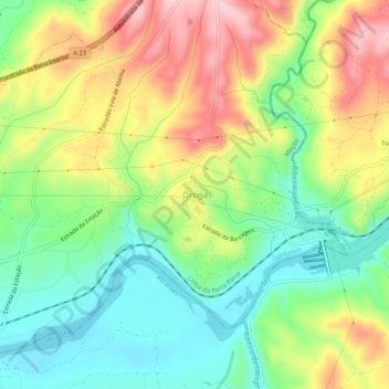
Name: Ortiga topographic map, elevation, terrain.
Location: Ortiga, Mação, Santarém, Centro, Portugal (39.46601 -8.03533 39.50601 -7.99533)
Average elevation: 111 m
Minimum elevation: 23 m
Maximum elevation: 234 m