
Stoughton topographic map
Interactive map
Click on the map to display elevation.
About this map
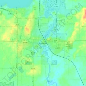
Name: Stoughton topographic map, elevation, terrain.
Location: Stoughton, Dane County, Wisconsin, 53589, United States (42.87674 -89.25790 42.95674 -89.17790)
Average elevation: 270 m
Minimum elevation: 251 m
Maximum elevation: 316 m