
New Buildings topographic map
Interactive map
Click on the map to display elevation.
About this map
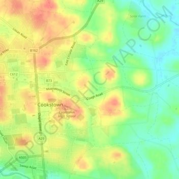
Name: New Buildings topographic map, elevation, terrain.
Average elevation: 66 m
Minimum elevation: 40 m
Maximum elevation: 89 m
County Tyrone trails, hiking, mountain biking, running and outdoor activities