
North Kawartha topographic map
Interactive map
Click on the map to display elevation.
About this map
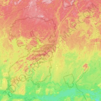
Name: North Kawartha topographic map, elevation, terrain.
Average elevation: 311 m
Minimum elevation: 217 m
Maximum elevation: 428 m
Other topographic maps
Click on a map to view its topography, its elevation and its terrain.
Chandos Lake
Canada > Ontario > North Kawartha
Chandos Lake, North Kawartha, Peterborough County, Central Ontario, Ontario, Canada
Average elevation: 321 m