
Kochsdorf - Kochanojce topographic map
Interactive map
Click on the map to display elevation.
About this map
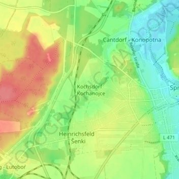
Name: Kochsdorf - Kochanojce topographic map, elevation, terrain.
Average elevation: 123 m
Minimum elevation: 94 m
Maximum elevation: 158 m
Other topographic maps
Click on a map to view its topography, its elevation and its terrain.
Talsperre Spremberg
Germany > Brandenburg > Spree-Neiße - Sprjewja-Nysa > Spremberg
Average elevation: 101 m