
Vätö topographic map
Interactive map
Click on the map to display elevation.
About this map
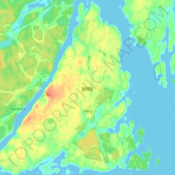
Name: Vätö topographic map, elevation, terrain.
Location: Vätö, Harg, Norrtälje kommun, Stockholm County, 76021, Sweden (59.77949 18.87327 59.86039 19.00505)
Average elevation: 12 m
Minimum elevation: -4 m
Maximum elevation: 40 m