
Geluveld topographic map
Interactive map
Click on the map to display elevation.
About this map
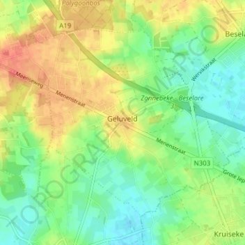
Name: Geluveld topographic map, elevation, terrain.
Location: Geluveld, Zonnebeke, Ieper, West Flanders, Belgium (50.81871 2.95926 50.84903 3.02184)
Average elevation: 40 m
Minimum elevation: 20 m
Maximum elevation: 65 m