
Rigaud topographic map
Interactive map
Click on the map to display elevation.
About this map
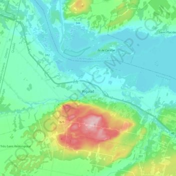
Name: Rigaud topographic map, elevation, terrain.
Location: Rigaud, Vaudreuil-Soulanges, Montérégie, Quebec, Canada (45.42995 -74.42165 45.53401 -74.20920)
Average elevation: 62 m
Minimum elevation: 17 m
Maximum elevation: 228 m