
Crossville topographic map
Interactive map
Click on the map to display elevation.
About this map
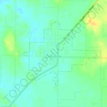
Name: Crossville topographic map, elevation, terrain.
Location: Crossville, White County, Illinois, United States (38.15430 -88.07500 38.17048 -88.05018)
Average elevation: 124 m
Minimum elevation: 115 m
Maximum elevation: 142 m
Other topographic maps
Click on a map to view its topography, its elevation and its terrain.
Burnt Prairie
United States > Illinois > White County
Burnt Prairie, White County, Illinois, United States
Average elevation: 130 m