
Hammam Boughrara topographic map
Interactive map
Click on the map to display elevation.
About this map
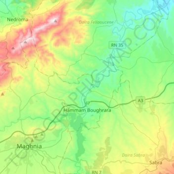
Name: Hammam Boughrara topographic map, elevation, terrain.
Location: Hammam Boughrara, Maghnia District, Tilimsen, 13036, Algeria (34.85786 -1.85523 34.98798 -1.58148)
Average elevation: 419 m
Minimum elevation: 112 m
Maximum elevation: 1,121 m