
Ambunti topographic map
Interactive map
Click on the map to display elevation.
About this map
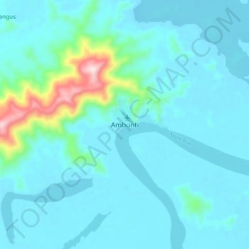
Name: Ambunti topographic map, elevation, terrain.
Location: Ambunti, East Sepik, Momase Region, Papua New Guinea (-4.25804 142.78253 -4.17804 142.86253)
Average elevation: 57 m
Minimum elevation: 4 m
Maximum elevation: 445 m
Other topographic maps
Click on a map to view its topography, its elevation and its terrain.
Lybia
Lybia, East Sepik, Momase Region, Papua New Guinea
Average elevation: 605 m
Angoram
Angoram, East Sepik, Momase Region, Papua New Guinea
Average elevation: 11 m
Keram River
Keram River, East Sepik, Momase Region, Papua New Guinea
Average elevation: 10 m