
Ljungby kommun topographic map
Interactive map
Click on the map to display elevation.
About this map
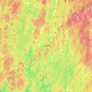
Name: Ljungby kommun topographic map, elevation, terrain.
Location: Ljungby kommun, Kronoberg County, Sweden (56.60076 13.29816 57.05182 14.30363)
Average elevation: 158 m
Minimum elevation: 101 m
Maximum elevation: 259 m
Other topographic maps
Click on a map to view its topography, its elevation and its terrain.