Geolocate

Merced topographic map

Click on the map to display elevation.

About this map

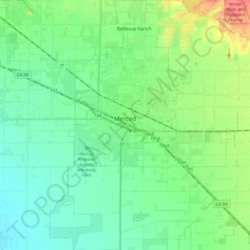
Name: Merced topographic map, elevation, terrain.

Location: Merced, Merced County, California, United States (37.22194 -120.54275 37.37573 -120.39952)

Average elevation: 53 m

Minimum elevation: 37 m

Maximum elevation: 96 m

Gear up for your next adventure:

👖Convertible Hiking Trousers - Versatile zip-off pants for changing mountain weather conditions
🌄Compact Monoculars - Lightweight optics for hiking
📦Dry Bags - Waterproof bags to protect gear from rain
📚UK Hiking Guidebooks - Detailed route descriptions for the Lake District, Peaks, and Highlands
🥾Hiking Boots - Waterproof and durable boots for long-distance hiking in the UK

As an Amazon Associate, this site earns from qualifying purchases at no extra cost to you.