
Sokanegara topographic map
Interactive map
Click on the map to display elevation.
About this map
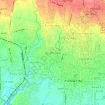
Name: Sokanegara topographic map, elevation, terrain.
Location: Sokanegara, Banyumas, 53115, Indonesia (-7.43706 109.21305 -7.39706 109.25305)
Average elevation: 87 m
Minimum elevation: 53 m
Maximum elevation: 130 m