
Yuriria topographic map
Interactive map
Click on the map to display elevation.
About this map
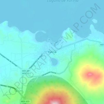
Name: Yuriria topographic map, elevation, terrain.
Location: Yuriria, Guanajuato, 38940, Mexico (20.17283 -101.17111 20.25283 -101.09111)
Average elevation: 1,817 m
Minimum elevation: 1,725 m
Maximum elevation: 2,330 m