
Castle Hill topographic map
Interactive map
Click on the map to display elevation.
About this map
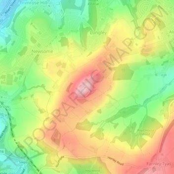
Name: Castle Hill topographic map, elevation, terrain.
Average elevation: 169 m
Minimum elevation: 74 m
Maximum elevation: 269 m
Other topographic maps
Click on a map to view its topography, its elevation and its terrain.
Castle Hill
United Kingdom > England > Kirklees > Farnley Tyas
Castle Hill, Castle Hill Side, Longley, Farnley Tyas, Kirklees, West Yorkshire, England, HD4 6TA, United Kingdom
Average elevation: 168 m