
Rt.31 topographic map
Interactive map
Click on the map to display elevation.
About this map
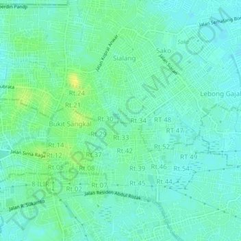
Name: Rt.31 topographic map, elevation, terrain.
Location: Rt.31, Palembang, South Sumatra, 30114, Indonesia (-2.95730 104.75935 -2.91730 104.79935)
Average elevation: 9 m
Minimum elevation: 3 m
Maximum elevation: 21 m