
Copelands Tetons topographic map
Interactive map
Click on the map to display elevation.
About this map
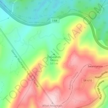
Name: Copelands Tetons topographic map, elevation, terrain.
Average elevation: 573 m
Minimum elevation: 437 m
Maximum elevation: 741 m
Other topographic maps
Click on a map to view its topography, its elevation and its terrain.
Churchville
United States > Virginia > Augusta County
Churchville, Augusta County, Virginia, 24421, United States
Average elevation: 467 m
Annex
United States > Virginia > Augusta County
Annex, Augusta County, Virginia, 24482, United States
Average elevation: 393 m
Reddish Knob
United States > Virginia > Augusta County
Reddish Knob, Augusta County, Virginia, United States
Average elevation: 1,120 m