
Grimstad topographic map
Interactive map
Click on the map to display elevation.
About this map
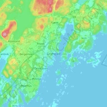
Name: Grimstad topographic map, elevation, terrain.
Location: Grimstad, Agder, 4876, Norway (58.30130 8.55341 58.38130 8.63341)
Average elevation: 31 m
Minimum elevation: -3 m
Maximum elevation: 171 m